

Nepean River: Pheasants Nest - Douglas Pk
04/05/15 00:50 Filed in: Nepean River
- RIVER:……..….Nepean River
- PUT IN:……..….Pheasants Nest Bridge, Hume Hwy
- TAKE OUT:…….Douglas Park Bridge
- RIVER HEIGHT:…..0.82 metres (gauge plot here)
- DISTANCE:…..……23.6 km
- TIME TAKEN: ……..7 hours
- MOVING TIME:……4 hours 30 minutes
- PHOTOS:…………. in HERE on google drive
- GPS MAP:…………..here on Strava or here on my site
The trip was organised by Steve from River Canoe Club.
On the trip were Steve, Dave, Matt, John and me.
PHOTOS on google drive HERE
River Height:
Nepean R at Pheasants Nest 0.82 Plot the waterway guide describes this as good
Stonequarry Creek at Picton 0.69 Plot
Downstream (maybe 10km from Douglas Park bridge)
Nepean River at Menangle Bridge 0.68 Plot the waterway guide has this level as minimum although seemed quite good.
Nepean R at Menangle Weir 0.85 Plot
Start: We met at Douglas Park Bridge at 9am and drive to Pheasants Nest Bridge on the Hume highway where it was a step hike down to the river via stairs to left of under the bridge. On the water about 10am and setting off by 10:1ish.
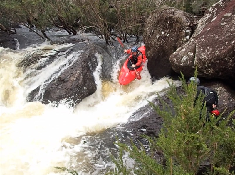
Description: We paddled everything except the Maldon Weir (portaged on the right). It was pool drop, pool drop sort of trip with a few rapids needing inspection. Some rapids had trees. There were tree bigger rapids before lunch which was had in a large overhang just above the Bargo River. A long flat pool above Maldon Weir and then some good waves in slightly larger rapids after the weir. With a lot of mucking around we took nearly 7 hours for the trip.
Finish: Finish is at Douglas Park Bridge on Douglas Park Drive.
the GPS shows 23.6 km and 4 hours 30 moving time in the 7 hours from start to finish.
On the trip were Steve, Dave, Matt, John and me.
PHOTOS on google drive HERE
River Height:
Nepean R at Pheasants Nest 0.82 Plot the waterway guide describes this as good
Stonequarry Creek at Picton 0.69 Plot
Downstream (maybe 10km from Douglas Park bridge)
Nepean River at Menangle Bridge 0.68 Plot the waterway guide has this level as minimum although seemed quite good.
Nepean R at Menangle Weir 0.85 Plot
Start: We met at Douglas Park Bridge at 9am and drive to Pheasants Nest Bridge on the Hume highway where it was a step hike down to the river via stairs to left of under the bridge. On the water about 10am and setting off by 10:1ish.
Description: We paddled everything except the Maldon Weir (portaged on the right). It was pool drop, pool drop sort of trip with a few rapids needing inspection. Some rapids had trees. There were tree bigger rapids before lunch which was had in a large overhang just above the Bargo River. A long flat pool above Maldon Weir and then some good waves in slightly larger rapids after the weir. With a lot of mucking around we took nearly 7 hours for the trip.
Finish: Finish is at Douglas Park Bridge on Douglas Park Drive.
the GPS shows 23.6 km and 4 hours 30 moving time in the 7 hours from start to finish.